Photos, times and coordinates
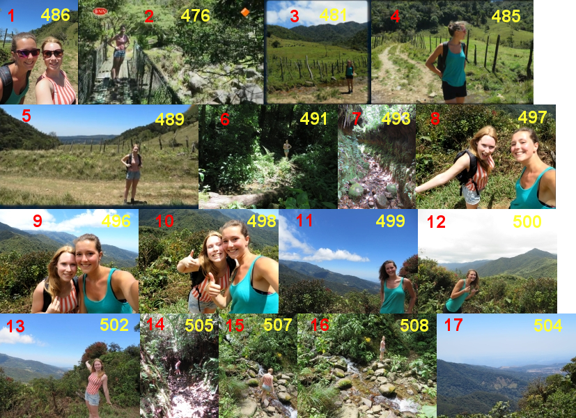
You can find more information about times of taking photos by Lisanne and Kris on the Cold Case blog. Not all of their photos are known in public. Here is a composition of most of the known photos taken on April 1st 2014. I numbered the photos from 1 to 17 so that it would be better to refer to them. Those numbers come from times before the new list of photos was released.
The following photo shows some places on the El Pianista trail.
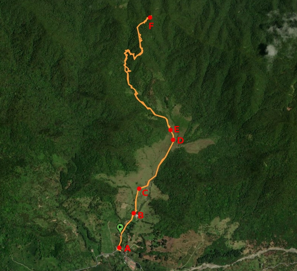
Here are coordinates of selected places on the El Pianista trail (latitude and longitude):
point A the restaurant Il Pianista 8.809315, -82.42733
point B the iron bridge 8.812407, -82.425896
point C the place where photo 3 was taken 8.815315, -82.425166
point D the place where photo 5 was taken 8.821247, -82.421156
point E the start of the forest 8.822101, -82.42165
point F the Mirador 8.834647, -82.42412
There is a valuable resource here - a map of the El Pianista trail and several dozen photos taken on the trail.
There is also a valuable resource here - a map of the trail beyond the Mirador and over a dozen photos taken on the trail.
Some maps showing places beyond the Mirador are here and here.
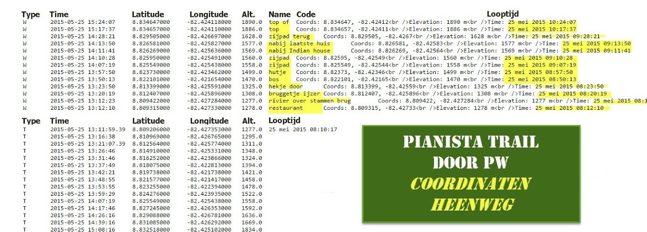
For selected photos I calculated the time of taking the photo based on the sun's position arising from shadows. Below I present a summary of my calculations in the following table:
Photo/place |
Calculated time |
Corrected EXIF time |
Estimation |
Restaurant Il Pianista |
|
|
10:48:26 |
Photo 2 (476) (iron bridge) |
11:08:06 |
11:18:24 |
10:56:35 |
Photo 1 (486) (bend) |
12:33:30 |
11:25:45 |
|
Photo 3 (481) (bend) |
11:41:39 |
11:25:11 |
|
Photo 4 (485) (bend) |
|
11:25:35 |
|
Photo 5 (489) (before forest) |
11:57:16 |
11:42:26 |
|
Photo 6 (491) (forest) |
|
12:03:08 |
|
Photo 495 (Mirador) |
|
13:00:23 |
13:00:23 |
Photo 10 (498) (Mirador) |
13:24:11 |
13:01:14 |
|
Photo 8 (497) (Mirador) |
14:04:13 |
13:01:06 |
|
Photo 15 (507) (stream, quebrada 1) |
14:15:34 |
13:54:50 |
|
Photo 16 (508) (stream, quebrada 1) |
13:17:42 |
13:54:58 |
|
The column "Calculated time" contains the results. The corrected EXIF time is used to compare with the results. The estimation column is based on the following times:
Conclusions:
1. The most exact result is probably the result for photo 2 (Kris on the bridge). It confirms that the girls started their hike at about 11:00 am. It is possible to determine the time of taking photo 2 with an accuracy of 5 minutes (see here).
2. Photo 1 (486) may have been taken the day before. That means that the girls may have been on the El Pianista trail between 12:00 and 13:00 on March 31st.
3. There is a problem with assigning photos of ravines to EXIF times. There seems to be only 2 times that would match the places where the 3 photos were taken. See point "Photos of ravines" how I tried to identify the places.