Photo 15 (507)
A photo of Kris taken by a stream.
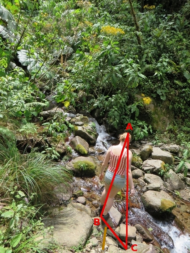
Photo 13-1
The following map shows coordinates of the place (quebrada in Spanish means a stream):
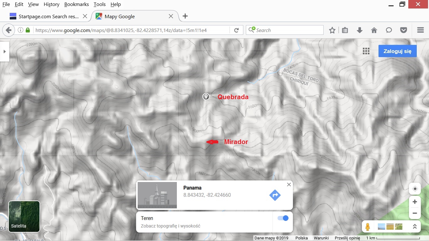
Photo 13-2
We have the following data needed to calculate the time of taking photo 15:
L = 136.0 pixels (the length of segment BC)
H = 283.0 pixels(the length of segment AB)
date = 2014-04-01 (April 1st 2014)
latitude = 8.843432
longitude = -82.424660
time zone = -5
DST = 0 (Daylight Saving Time, there is no DST in Panama)
The results obtained by means of method 1 (here is a description of method 1):
elevation = 64.33 deg. (cell B55 in the spreadsheet)
local time 1 = 14:15:34
azimuth 1 = 262.40 deg.
local time 2 = 10:51:26
azimuth 2 = 97.60 deg.
From the point of view in the photo, Kris is too short, and we do not know exactly where is the end of the shadow. These are disadvantages of the measurement.
In the case of the photo, it is worth to check the direction of the shadow. It is approximately along the stream. It is worth to find the place and determine the azimuth 260 degrees. That is approximately the azimuth of the sun at 13:54 on April 1st. 13:54 is the corrected EXIF time of the photo.
The map below shows the location of the place.
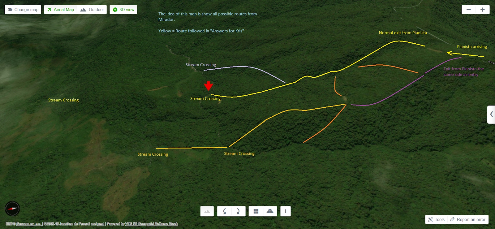
Photo 13-3
I found the map on the Cold Case blog. The place is marked with the red arrow. The map is rotated. The north is on the left.
Below, you can see another map.
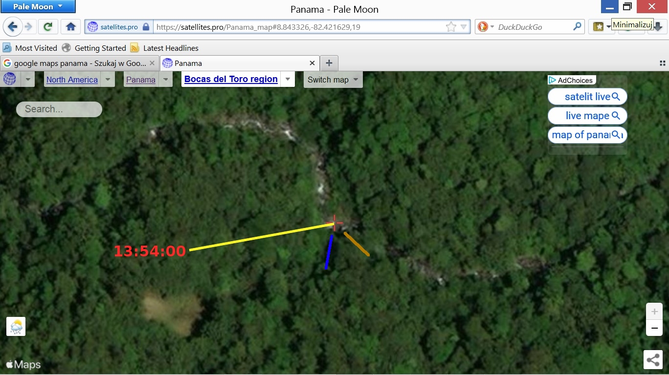
Photo 13-4
The yellow line shows the azimuth of the sun at 13:54. The blue line shows the possible direction of the path from the Mirador. The brown line shows the direction of the path arising from what we see in photo 507 (see the brown line at the bottom of photo 507 above). Those are only my speculations about the possible direction. I just wanted to illustrate the problem. If there was a difference between the two directions, it would mean that the time of taking the photo was different.
Here is another map that allows to find the location of the place. The black rectangle contains the area from the above map.
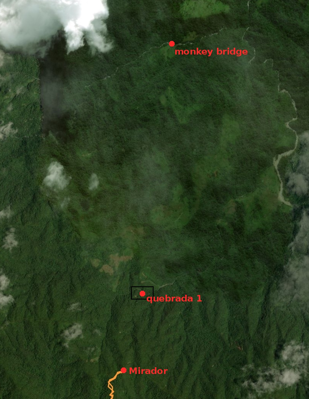
Photo 13-5
On the map, I marked the possible location of the monkey bridge shown in the "Lost in the Wild" episode about Kris and Lisanne.
The map below shows another position of the stream (quebrada 1).
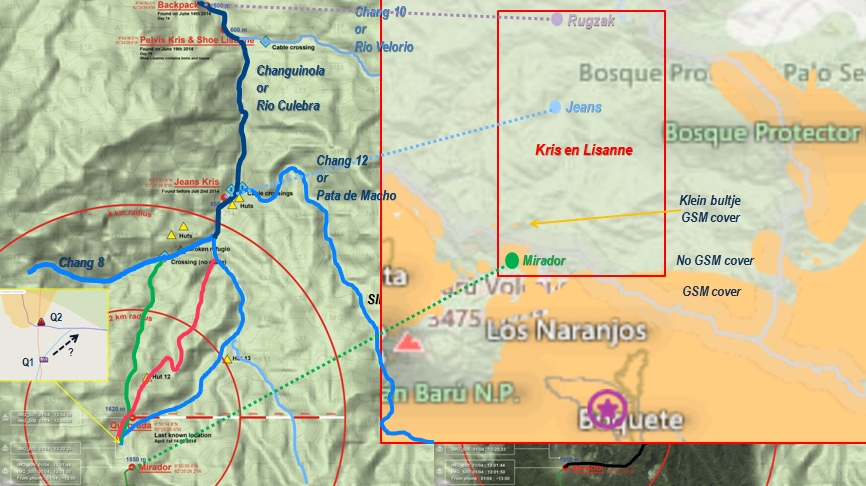
Photo 13-6
I found the map on the Russian website. On the map, quebrada 2 is also marked (see the yellow rectangle at the bottom on the left, Q1 - quebrada 1, Q2 - quebrada 2). According to the map quebrada 2 is to the north of quebrada 1. Quebrada 2 is the place visited by Kris's parents in this film (11:53 quebrada 1 is visible, 13:20 quebrada 2 is visible). I tried to guess the exact coordinates of quebrada 1 on the above map: 8° 50'34.8''N, -82° 25'25.4''W (8.843,-82.423722).
The map below shows the position of quebrada 2, but it is almost at the same place as quebrada 1 on the map above (photo 13-6).
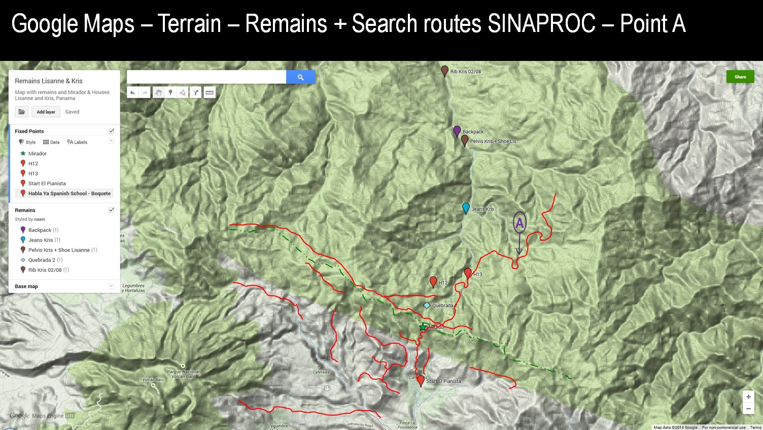
Photo 13-7
Another map that I found on the German forum (link to the map).
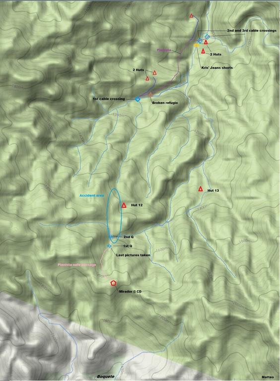
Photo 13-8
These are possible coordinates of quebrada 1 (the stream crossing to be exact):
1) 8.843326,-82.421629 (photo 13-4);
2) 8.843000,-82.423722 (photo 13-6);
3) 8.841596,-82.424944 (photo 13-8).
The approximate coordinates of quebrada 2 (the stream crossing): 8.843801,-82.424643 (photo 13-8).
The map below shows positions of both quebradas and the Mirador.
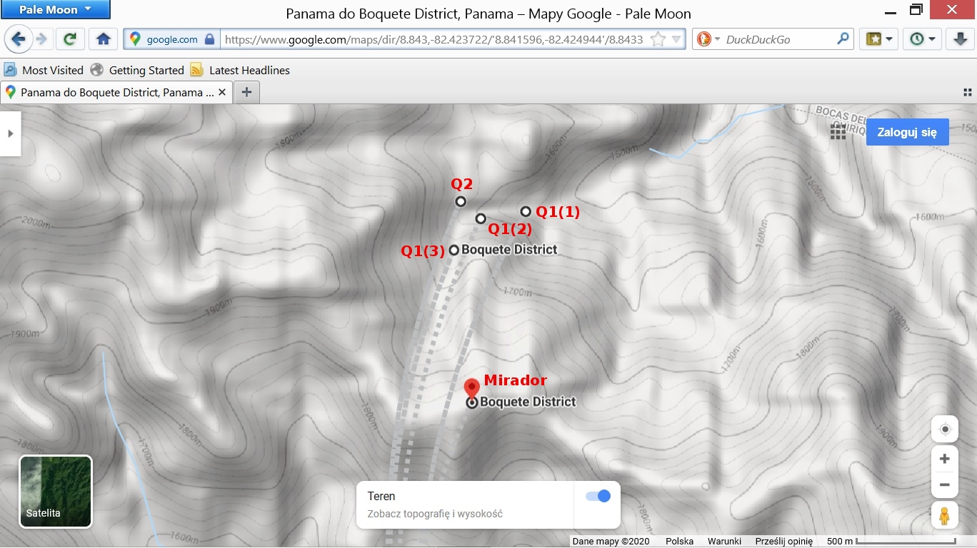
Photo 13-9
Below is a satellite map showing the above positions:
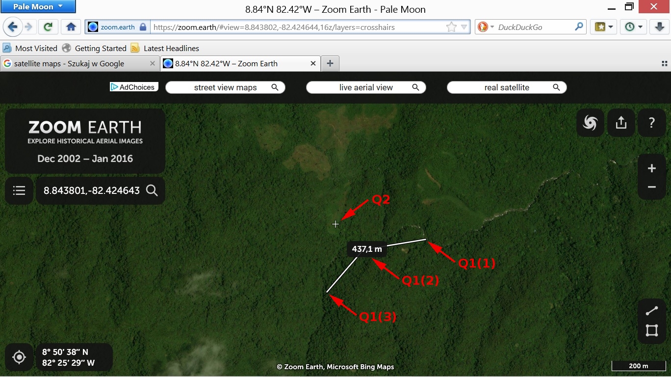
Photo 13-10
The distance between points Q1(1) and Q1(3) is 437 m.
Another map from the German forum that shows a possible path from the Mirador to quebrada 1.
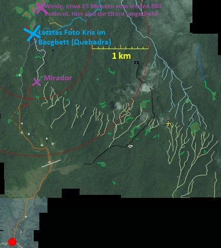
Photo 13-11
And another map - a better version of the map in photo 13-6 (coordinates are easier to read).
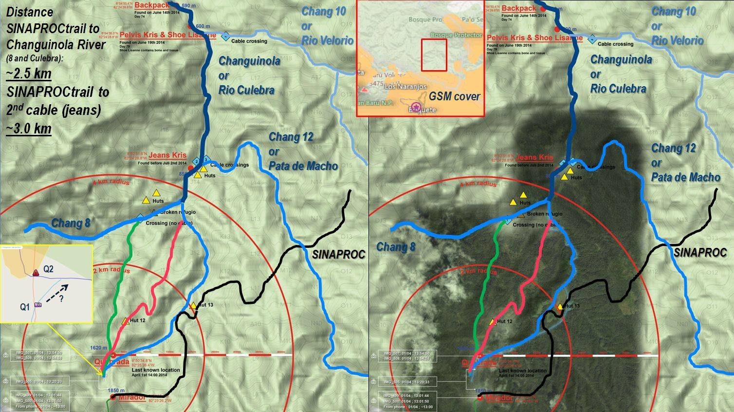
Photo 13-12
Here is a link to another map (ArcGIS) where you can find many places concerning the case of Kris and Lisanne. On the map, you can find different positions of quebrada 1 and 2. I placed them on the following map where I marked the distance between the Mirador and both quebradas:
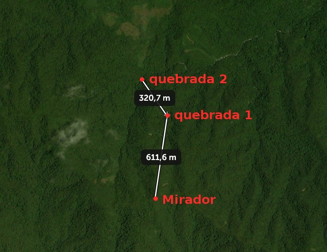
Photo 13-13
These are the coordinates of both quebradas on the above map:
quebrada 1: 8.840271,-82.422914;
quebrada 2: 8.842551,-82.424732;
There is some confusion about the exact positions of both quebradas. It would be good to explore the area beyond the Mirador by an investigation team and determine the exact positions of the stream crossings.