Photo 3 (481)
A photo of Lisanne taken on the El Pianista trail.
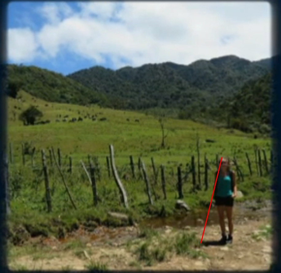
Where is the place where the photo was taken? This film can help in locating the place on the El Pianista trail. In the film, the men on motorcycles are getting across the river at 3:00. It is not far from the bridge visible in photo 2. Then they are reaching a bend at 4:20. That is the place where photo 3 was taken.
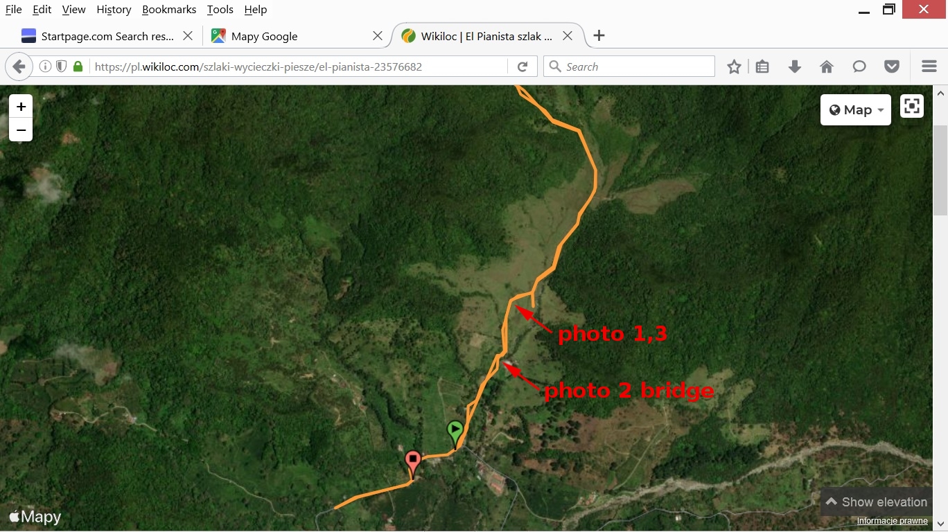
This is a map of the El Pianista trail with marked places where photos 1, 2, 3 were taken.
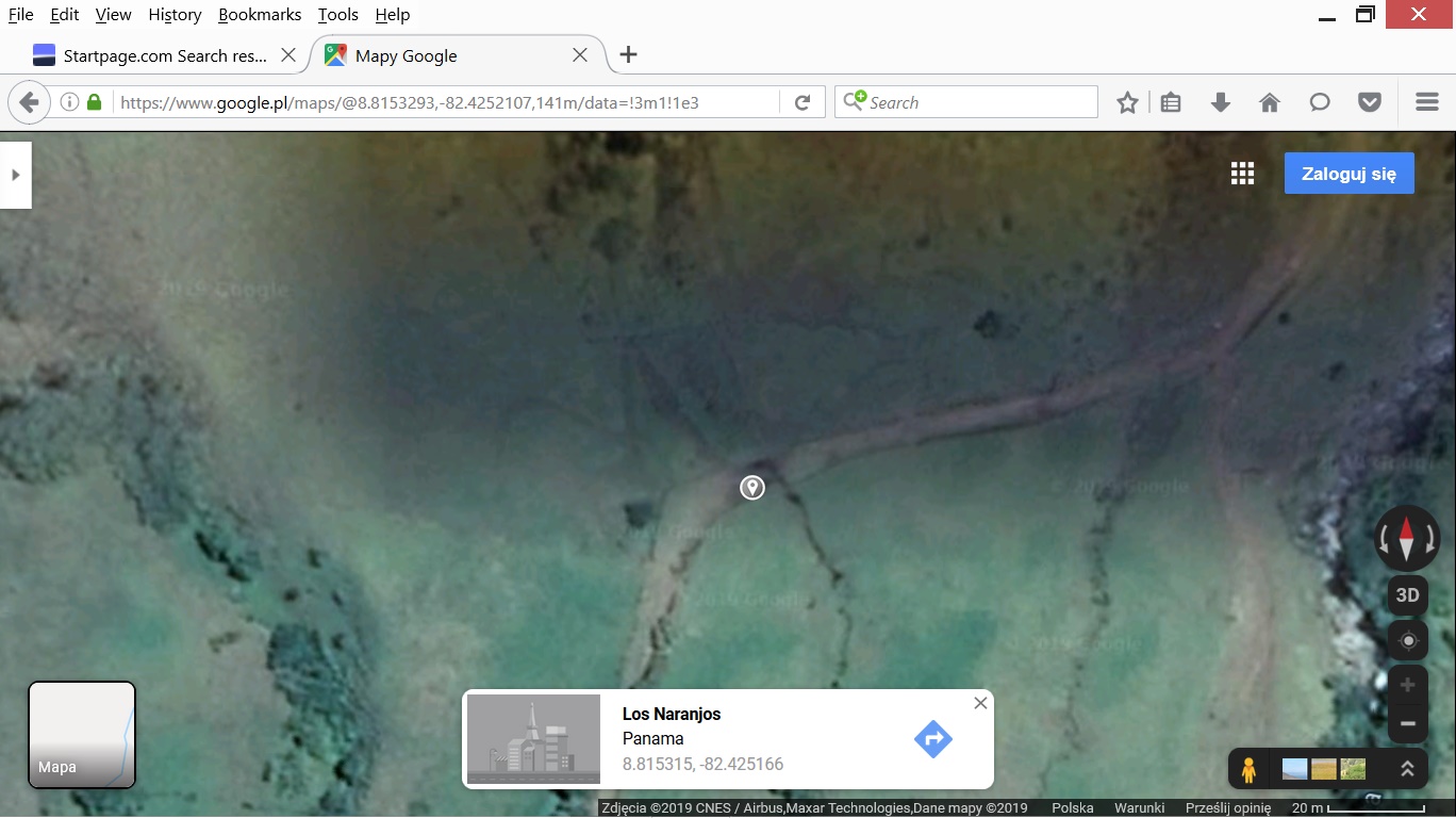
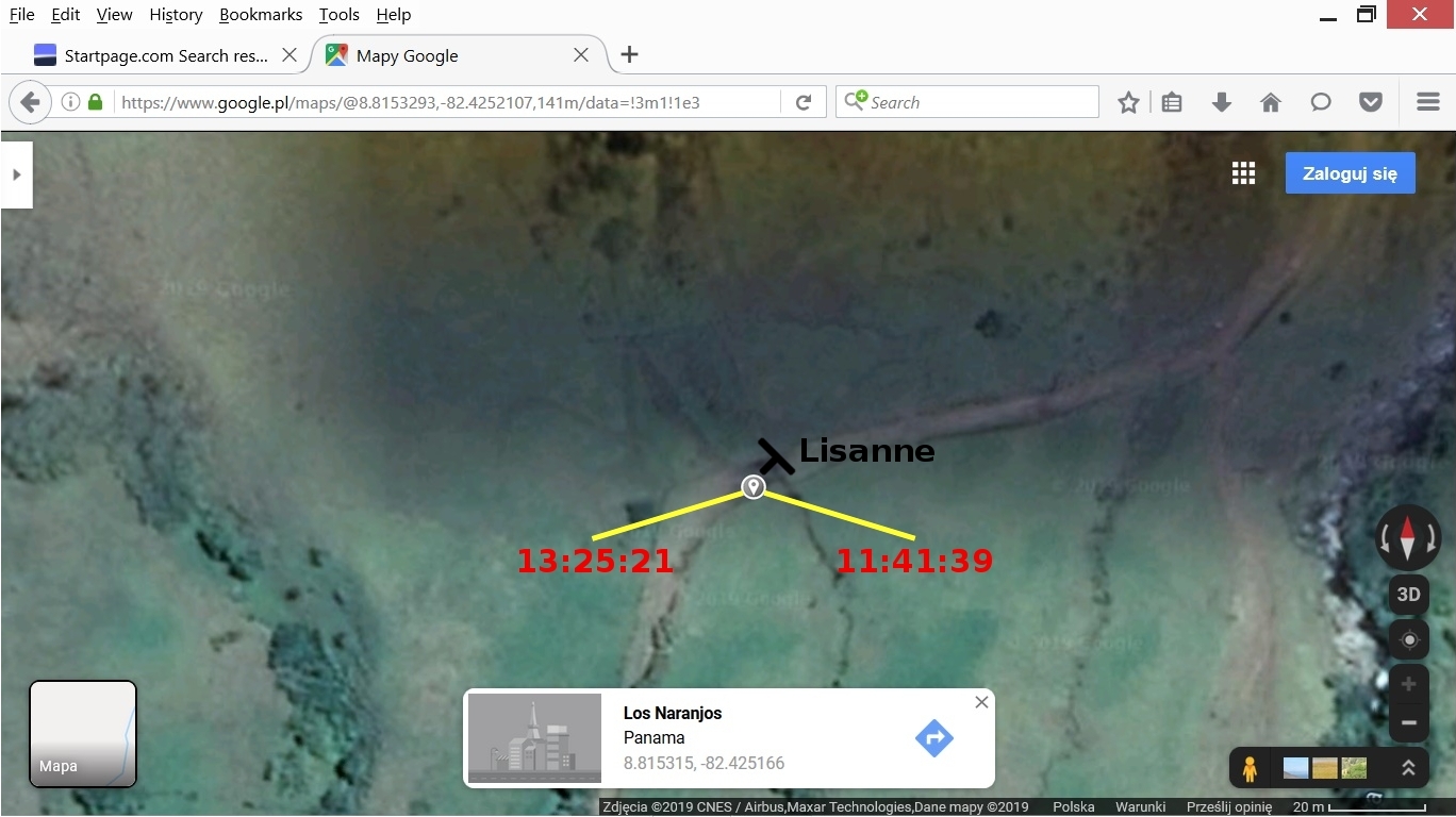
The map below shows the coordinates of the place.
I used the Measure Tool in GIMP to measure the height of Lisanne and the length of the cast shadow:
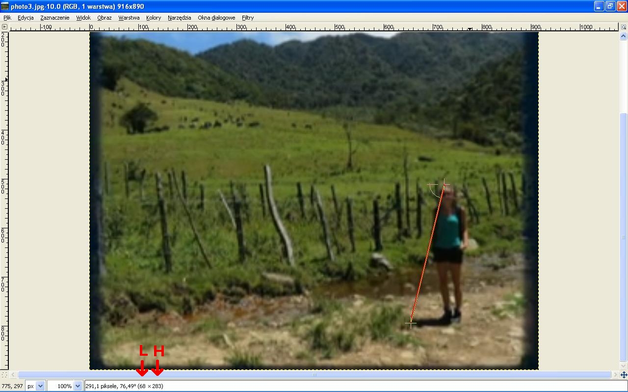
The arrows at the bottom on the left point at the measured values.
So we have the following data needed to calculate the time of taking photo 3:
L = 68.0 pixels
H = 283.0 pixels
date = 2014-04-01 (April 1st 2014)
latitude = 8.815315
longitude = -82.425166
time zone = -5
DST = 0 (Daylight Saving Time, there is no DST in Panama)
The results obtained by means of method 1 (here is a description of method 1):
elevation = 76.49 deg. (cell B55 in the spreadsheet)
local time 1 = 13:25:21
azimuth 1 = 253.11 deg.
local time 2 = 11:41:39
azimuth 2 = 106.89 deg.
The photo below shows the directions related to the above times and azimuths. The rotated letter T indicates the position of Lisanne. The sun shines from the right so I would choose the time 11:41:39 of taking photo 3.
There is an obvious potential source of an error of the above calculations: the grass in photo 3 obscures the cast shadow so we do not know where is the end of the shadow.